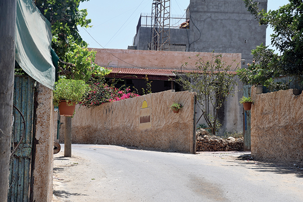
Courtesy of UN-Habitat Palestine Programme
Area C of the West Bank, as it stands today (sixty percent of the West Bank that fall under full Israeli control), creates a state of gradual decline for the meaningful development of Palestinians. It is characterized by formidable challenges regarding control and territorial reduction that weaken the structure and viability of Palestinian statehood. Area C is a cornerstone to the sustainable development of a Palestinian state, since it contains not only valuable natural resources and a rich cultural heritage, but also represents the bulk of available land for future spatial development. Furthermore, Area C holds a considerable, yet so far untapped potential, as it is inhabited by only six percent of Palestinians in the West Bank and as such drives the phenomenon of artificial land scarcity in Palestine. The geo-political designation of the West Bank into three areas (A, B, and C) with different levels of authority was meant to be a temporary stage to enable the discussions for a phased allocation of lands to the Palestinian side, but this transition has never been done due to the political impasse in the peace process. Nevertheless, the status of the West Bank overall as land occupied by Israel was not altered, and Palestinians are defined under international human rights law as a “protected population” and Israel as an “occupying power” that is not sovereign in the territory and therefore prohibited from making permanent changes; rather it must protect the status quo.
♦ UN-Habitat, together with other local and national stakeholders has been engaged in different spatial planning interventions for the past four years, providing support to vulnerable Palestinian communities in the Israeli occupied Area C of the West Bank to defend their building and planning rights that have been undermined by the measures enforced by the Israeli authorities, chiefly the Israeli Civil Administration (ICA), which is part of the Israeli army apparatus.
UN-Habitat, as the UN agency for human settlements, is mandated by the UN General Assembly to promote socially and environmentally sustainable towns and cities with the goal of providing adequate shelter for all. UN-Habitat’s programs are designed to help policy makers and local communities come to grips with the issues of human settlements and urban planning and to find workable and lasting solutions. In 2003, conscious of the special housing and human-settlements needs of the Palestinian people, and recognizing that they fall within the technical mandate of UN-Habitat, the Governing Council of UN-Habitat endorsed the establishment of the Special Human Settlements Programme for the Palestinian People (SHSPP).
One of the visible interventions of the UN-Habitat programs in Palestine has been the Planning Support Programme for Palestinian Communities in Area C of the West Bank (2012-2015). The main objectives of this program could be boiled down into: satisfying an acceptable level of legalization to stop the increasing number of housing demolition orders issued by the Israeli authorities; and spearheading spatial development plans that guarantee the provision of infrastructural lines, economic functions, and housing. More specifically, a panoply of planning interventions has been introduced to harness the associated economic potentials of the areas that are currently affected by discriminatory planning restrictions, including: (1) the preparation of four planning policy papers as inputs for the main national partner, the State of Palestine Ministry of Local Government (MoLG); (2) the preparation of 145 multi-layered spatial plans drafted with input from the local communities to foster development and resist the occupation’s discriminatory planning processes; (3) the mobilization of over 10,000 Palestinians in participatory planning processes, which in turn has contributed to the development of their resilience and community cohesion; (4) the protection of more than 55,000 Palestinians in Area C and East Jerusalem from eviction and forced displacement; and (5) the continued efforts to ensure a high level of coordinated advocacy activities. A result of the last point is the report of the Independent International Advisory Board on Spatial Planning in Area C that examined the planning situation in Area C, benchmarked against international quality standards local outline plans that were prepared by and with Palestinian communities, and concluded that these local outline plans are technically sound and should be endorsed by the Israeli authorities, namely the Israeli Civil Administration (ICA), without any further delays.
In September, 2015 the UN family in Palestine adopted a “One UN” Approach to Spatial Planning in Area C of the occupied West Bank in which it assured that it will continue to advocate for the transfer of planning powers in Area C to the Palestinians – to the largest extent possible and as an essential component in the state-building process. The intention is that this approach will make development interventions more concrete by meeting the current needs of Palestinians, without undermining their future aspirations and rights to planning and development.
Spatial planning interventions in the geo-political context of Area C are not rudimentary from the outset. The bulk of Palestinian communities in Area C are threatened by demolitions and displacement. According to official Israeli data, more than 11,000 Demolition Orders against ca. 17,000 Palestinian-owned structures in Area C have been issued. Furthermore, land delineations in Area C show sober realities in terms of planning inequalities: in 2014, plans for Palestinians targeted 0.4 percent of Area C land compared to 20.1 percent designated for illegal Israeli settlements. Area C is considered a cornerstone for the sustainability of Palestinian statehood. A World Bank report in 2014 showed that alleviating Israeli restrictions in Area C would generate a sum equivalent to thirty-five percent of the Palestinian GDP in 2011, including direct and indirect benefits, which translates into $800 million a year of additional tax revenues for the Government of Palestine. These numbers reflect the prevailing planning crisis in Area C and the squandered development opportunities that could be unlocked for the benefit of Palestinian communities.
The Case of Imneizil Village, South of Hebron
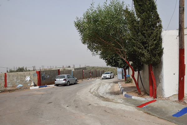
Imneizil is a small Palestinian village south of As Samu’, about nine kilometers away from the southern parts of the mother town of Yatta and seventeen kilometers south-west of Hebron city, bordering the Green Line (Armistice Line for the year 1949). Imneizil is inhabited by nearly 450 Palestinians, or sixty families of an average size of 7.5 family members. The village is a hot spot in the Israeli occupied Area C of the West Bank. Because of its proximity to the Israeli matrix of control – located between the separation barrier, nearby Israeli settlements, and by-pass roads – the village has come under the serious threat of forcible displacement, and as it lacks statutory local outline plans, most of the new houses and constructions in the village that were built after 1990 are under the threat of demolition. Under the supervision of the MoLG and the International Peace and Cooperation Centre (IPCC) and with financial support from the UK, Imneizil village prepared a local outline plan that was submitted to the ICA in July 2011. In March 2014, after multiple rounds of negotiations with the ICA, further detailing to the local outline plan – and with EU funds and technical support from UN-HAbitat – the ICA finally endorsed the plan, thus making it one among the first three Palestinian-led plans ever to be approved by the Israeli authorities. To further engage the local inhabitants in the plan-making and to establish a connection between the inhabitants and the built environment, especially the public space, UN-Habitat, in collaboration with the MoLG, the IPCC, and other local partners, initiated a non-statutory planning approach, called Placemaking, to turn the public space in Imneizil into livable places. More specifically, designs for village roads, school surroundings, and a public playground were made with the local inhabitants in a participatory way and drafted in three iterative rounds of consultations with women, youth, elderly, and others from the local community of Imneizil. Some of these designs were funded by the EU via community contracting in order to implement some of the prioritized projects under the local community action plan that had been endorsed by the Village Council of Imneizil. At this time, other donors are investing in the village by building new roads and public facilities according to the approved plans, a practice that represents a model to other Palestinian villages in Area C: local communities have been empowered to plan for their villages, which has rendered the inhabitants more resilient and assured their confidence to plan and develop “for a better urban future”.
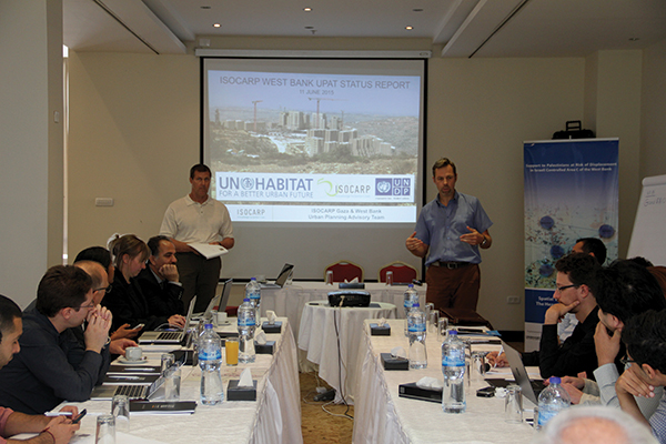
UN-Habitat will continue to work closely with its national partner, the MoLG, and with other local and international stakeholders to support the delivery of spatial planning interventions needed to enable sustainable development in Area C and in the West Bank at large. Gender and human rights mainstreaming will continue to be the guiding principles for its implementation strategy, working in ways that are geo-politically responsive and socio-economically and environmentally sensitive in order to ensure sustainability of the introduced spatial planning interventions and to support the flag-ship project of building Palestinian statehood.
» Ahmad El-Atrash has a PhD in Spatial Planning from TU-Dortmund University, Germany. He is a project manager and senior urban planner at the UN-Habitat office in Palestine. He has solid experience and interest in issues related to geo-political and strategic planning, governance reform, resilience, and sustainable development within the Palestinian context. He can be reached via email at: ahmad.el-atrash@unhabitat.org

