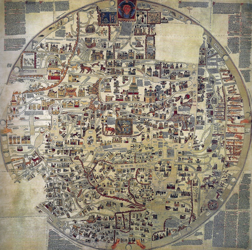
Gervase of Ebstorf (most likely) painted this map in the thirteenth century on thirty goatskins sewn together, measuring around 3.6 by 3.6 meters (12 ft × 12 ft). While the original was destroyed in 1943 during the Allied bombing of Hannover, there survive a set of black-and-white photographs, taken in 1891, and several color facsimiles.
The Ebstorf Map is an example of a mappa mundi (a Medieval European map of the world), a greatly elaborated version of the common medieval T and O map that shows the Orbis terrarum (Latin for circle of the lands). Such tripartite maps are organized with a horizontal letter T enclosed by a letter O, based on the Aristotelian belief in a spherical earth with three climate zones: frigid clime at the north, a deadly torrid clime near the equator, and a temperate clime in the middle – Aristotle believed that nobody could cross the deadly torrid zone to reach the southern hemisphere, thus it was not included in maps.
The head of Christ is depicted at the top in the Garden of Eden, his hands on both sides, his feet at Gibraltar, and centered at his navel Jerusalem next to the tower of Babel and Bethlehem.i With east at top, it shows Europe in the lower left, Rome represented by a lion. Separated by the Mediterranean Sea, Africa spans the entire right side and includes, among mythical creatures, the tribe of dwarfs riding crocodiles. Asia, in the upper left, shows opium eaters, Alexander the Great consulting the Oracle of the Sun and Moon, two Amazonian women guarding their citadel, and the landing point of Noah’s ark. The earth is surrounded by water inhabited by fish and with circles that represent the homes of the twelve winds floating within. The text around the map, incorporating both pagan and biblical history, includes a narration of the creation of the world, descriptions of animals, and definitions of terms.
i. Chris Mueller, http://blog.visualmotive.com/?s=ebstorf


