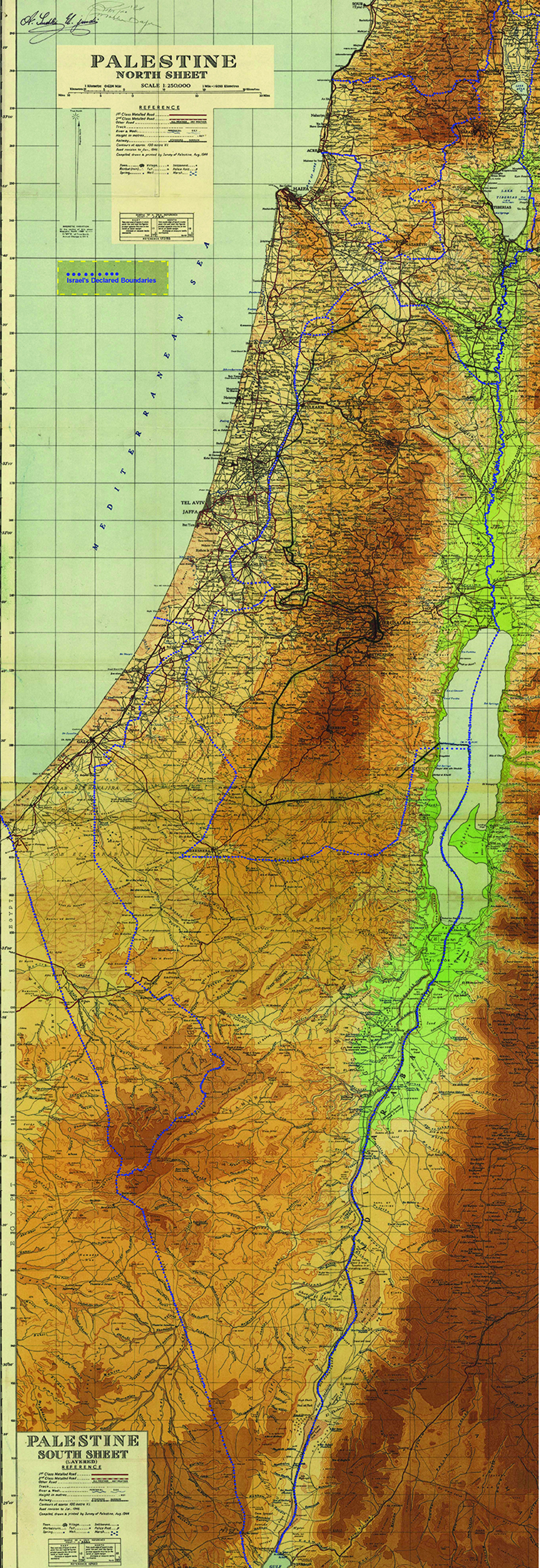
This map shows the topography of Palestine – with the low coastal areas, the central hills, and the Jordan valley – on a map that was drawn in 1944 and therefore shows the Palestinian villages that were later destroyed by Israel. In 1949, this map was used during the armistice negotiations in which details of the Israeli-Jordanian border were agreed upon. It shows the Armistice Line as a black line, the UN Resolution 181 proposal in blue dots, and bears the signatures of Moshe Dayan, the Israeli military leader, and Ahmed Sudki El Jundi, the negotiator for Jordan.


