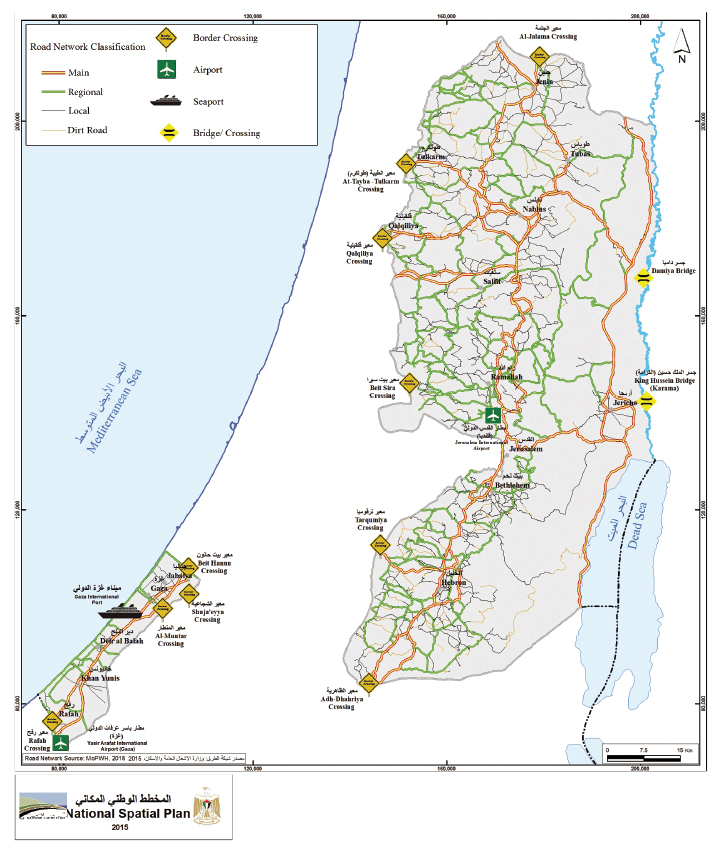
This map includes the internal road network, that that is random and underdeveloped, as well as the connection to “the outside world” that consists of two airports that are not functioning, a sea port that is not accessible (Gaza port is not suitable for anything but small fishing boats and may not be extended, while larger boats that could anchor offshore may not approach without Israeli approval), and the border crossing points that – apart from the almost always closed Rafah crossing – lead either to Israel or to Jordan, but via Israel. All these connections are under Israeli control, which means that Israel at any time can impose complete closure not only on Gaza but also on the West Bank, and this is applicable not only to people but also to goods. The existing 500 permanent and temporary internal Israeli checkpoints cannot be displayed on this map since this information would exceed the available space. Furthermore, Israel has strategically positioned its road network that connects settlements and military outposts in ways that fragment the Palestinian villages and towns in a system that has been called the Matrix of Control.i
Map and caption courtesy of Palestinian Ministry of Planning.
i. Jeff Halper, The Matrix of Control, The Israeli Committee Against House Demolitions, 2015.


