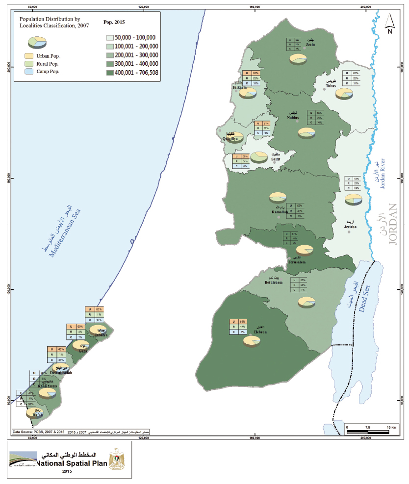
This map shows that, with the exception of the Salfit governorate, the majority of the 4,5 million Palestinians that live in the occupied territories constitutes an urban population. This classification holds true even for the fertile Jordan Valley that is largely classified as Area C, and therefore not freely accessible for agricultural use, and it is certainly accurate for Gaza, where there is close to no rural area (except for near Khan Younis), while the population that is not urban is refugees. Another indicator that can be deduced from this map is population density, which has significance for governments since it is important for the distribution of services and infrastructure. About 90% of Palestinians live on only 7% of the land (not all of Area A is actually built up).The average population density of the West Bank is about 400 capita per sq km, Gaza has a population density of 4,000 capita per sq km (which is among the highest worldwide and comparable to the slums in major metropoles, such as Rio de Janeiro); there is less population density in the Jordan Valley and the Salfit Governorate.
Map and caption courtesy of Palestinian
Ministry of Planning.


