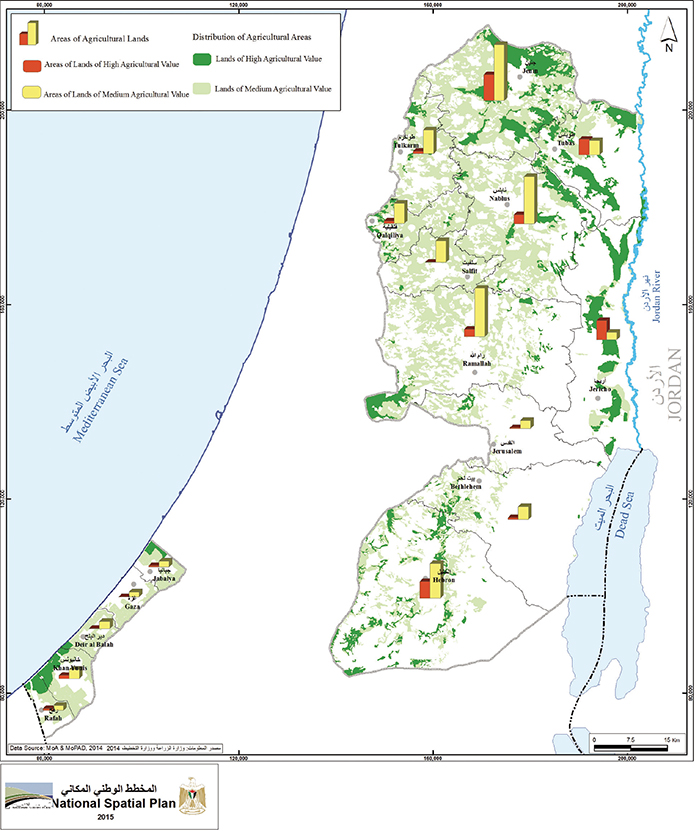
Agricultural lands in the West Bank and Gaza Strip are classified into high-valued, medium-valued, and low- valued quality lands according to the provisions of the Protection Plan for Natural Resources and Archeological Sites which was validated by the Palestinian cabinet in 2014. Accordingly, the northern governorates have 532 km2 of highly-valued agricultural lands and 1,540 km2 of medium-valued agricultural lands, while in the southern governorates there are about 35.5 km2 classified as highly-valued agricultural lands and 164.8 km2 as medium-valued agricultural lands. The National Spatial Plan of the Palestinian Ministry of Planning restricts the use of high-value land for agricultural use only. Such classification applies to 9% of the West Bank and includes all areas that are “green” and have a slope of less than 5%. Standard crop includes grains and vegetables. Medium-level agricultural land is land used for trees, such as olives, almonds, figs, and grapes. In terms of food security, the limiting factor is access to water, rather than availability of land with suitable soil. With adequate water supply, Palestine could enjoy food security on a long-term basis.
Map and caption courtesy of Palestinian
Ministry of Planning.


