

Since the early days of occupation, the Israeli authorities have used maps as a tool to dispossess Palestinians, establish de facto sovereignty over the occupied territory, and engineer a fabricated statehood. The socio-spatial consequences of map-making, as a form of authority-making, in present-day Palestine become “stubborn realities” that tend to perpetuate in a state of permanent temporariness due to Israel’s prolonged military occupation of territory. In this article, maps are best understood as discourses that create knowledge, particularly so in sensitive geo-political contexts such as the one in which we live. This article focuses on the context of map production in present-day Palestine and is divided into three main sections, namely: maps as a cartographic battlefield, maps as geo-political visions, and maps as political propaganda.
Maps as a Cartographic Battlefield – The Separation Barrier
The way in which the Israeli authorities use spatial maps and cartographic codes in present-day Palestine is reminiscent of battle plans and accentuates a symbolic connection with warfare. The Israeli political scientist Meron Benvenisti wrote in his book Sacred Landscape, “Map making is one of the specialized intellectual weapons by which power could be gained, administered, given legitimacy, and codified.”ii Elqouent Edward Said makes it clear that the main task for Palestinians is to comprehend the overall map of the occupied territories that Israel has been creating and then to devise concrete tactics of resistance. “In the history of colonial invasion, maps are always first drawn by the victors, since maps are instruments of conquest. Geography is therefore the art of war, but it can also be the art of resistance if there is a counter map and a counter strategy.”iii
A prominent example in this regard is the Separation Barrier that Israel started to build in 2002 in the West Bank. Allegedly, it is erected for “security reasons,” but it stands as a formidable physical obstruction that disintegrates the social fabric of Palestinian communities, especially in and around Jerusalem city. Interestingly, in his book Hollow Land, the Israeli architect Eyal Weizman mentally maps the space that is produced/re-produced/co-produced by the Separation Barrier between present-day Palestine and present-day Israel as two separate entities above each other.iv Connected by a web of physical infrastructure this space only provides a means of transportation, rather than territorial contiguity. In more mundane terms, the Separation Barrier, as demarcated on the Israeli maps, engenders a big lie! The Separation Barrier not only annexes more than ten percent of West Bank territory in the western parts, it also confiscates the bulk of the available natural resources, especially fertile agricultural lands and water aquifers, that are considered a cornerstone to Palestinian statehood. Furthermore, the map-making of the Separation Barrier does not plainly reveal its intention of creating demographic hegemony over Jerusalem, where more than fifty-six percent of Palestinian Jerusalemites will be excluded from residing and accessing their home town. This will cause the percentage of Palestinians living in Jerusalem city and its immediate peripheries to plummet to only fifteen percent, almost half of the current number, and thus consolidate the Israeli plan for a Greater Jerusalem that intends to render impossible any claims by Palestinians to their spiritual and political capital city. To this end, the Separation Barrier incorporates major Israeli settlements blocs that have been built in West Bank territory – the Giv’at Ze’ev block in northern Jerusalem, the Ma’ale Adumim block in eastern Jerusalem, and Gush Etzion southwest of Jerusalem – which all together comprise about seventy percent of the Israeli settlers living in the West Bank (see map with Separation Barrier).
Maps as Geo-Political Visions – The Green Line
Map-making in present-day Palestine has a strong correlation to the building of the Palestinian nation-state. In this undertaking, one should distinguish between mapping practices geared towards Palestinian nation-building and those used for state-building.v
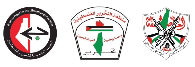
Readily, Palestinian mapping practices undertaken for the aim of nation-building emphasize borders, and in such a context, the shape of the historic nation is used as a logo that helps build a sense of national belonging. Examples of such a use of maps include the logo of the Palestinian Liberation Organization (PLO, the political umbrella organization that represents Palestinians across the world), that shows the entire Historic Palestine of the pre-1948 borders. This logo is used despite the fact that the political program of the PLO claims hegemony only over the areas inside the 1967 borders of the West Bank, East Jerusalem, and Gaza Strip. Moreover, many Palestinian academics and civil society activists use the pre-1948 border in their maps to symbolically represent Palestinian identity when addressing Palestinian concerns, such as the repatriation of Palestinian refugees.
In parallel, when local stakeholders attempt to engineer a Palestinian statehood in the post-Oslo era and under the framework of the national flag-ship project of “end the occupation, build statehood,” they tend to be propelled to adopt the internationally-recognized borders of 1967 (aka Armistice Line of 1949) when delineating the Palestinian state, as they constitute a more feasible option. But beyond ideological objectives for the practical reasons of depicting Palestinian reality in light of the transitional legal status of the Oslo designations of 1995, cartographers must continuously strive to find solutions to challenges associated with the geographic representation of various Palestinian communities. This is proving rather difficult in face of ever-growing complexities that result from the Israeli creation of new geo-political facts on the ground through the persisting expansion of Israeli settlements and the associated physical obstructions that ultimately undermine the Palestinian state-building project. Therefore, various Palestinian state- and non-state actors are advocating different, and often conflicting, geo-political visions. But this state of confusion is not to be misinterpreted in any way as a political myopia of the Palestinian side; rather, this is best understood in context of the fact that map-making is heavily affected by geo-political status and the conditions on the ground.vi
Maps as Political Propaganda – The Israeli Settlements
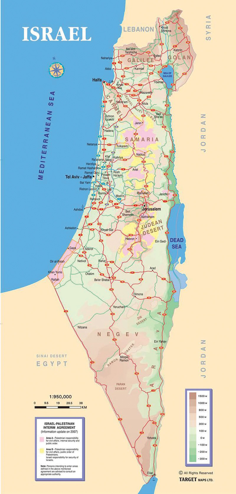
The Israeli authorities have produced maps that are circulated internationally for political propaganda. A recent example is “Your Next Vacation: Israel” issued by the Israeli Government Tourism Office/IGTO. This map shows the West Bank, including East Jerusalem, under the labels “Samaria” and “Judean Dessert” and the Occupied Syrian Golan Heights as integral part of Israel (see map on this page). Ironically, this map shows Areas A and B, which fall under Palestinian planning jurisdiction, but it does not make any reference to most of the Palestinian communities in the Israeli-occupied Area C that constitutes more than sixty percent of the West Bank, as designated in the Oslo Agreements (1995). A large portion of the more than 300,000 Palestinians living in Area C thus have been wiped off the map by simply not being traced on it. In many cases this is because the Israeli authorities do not recognize these Palestinian communities, have rendered them illegal, and issued eviction notices, even though such a measure is in contradiction to the Geneva Conventions. More interestingly, this map does not identify the Israeli settlements in the West Bank, that are deemed illegal according to international law, and thus, the more than half-a-million Israeli settlers that live in the West Bank have been intentionally mis-presented as indigenous population rather than occupiers.
» Ahmad El-Atrash has a PhD in Spatial Planning from TU-Dortmund University, Germany. He has solid experience working with think-tanks, academic institutions, NGOs, donors, and UN agencies in issues related to geo-political and strategic planning, governance reform, resilience, and sustainable development within the Palestinian context. He can be reached at ahmad.elatrash@tu-dortmund.de.
i. The title is inspired from M.S. Monmonier, (1996), How to Lie with Maps, The University of Chicago Press.
ii. See M. Benvenisti, (2002), Sacred Landscape: The Buried History of the Holy Land since 1948, University of California Press, pp. 44.
iii. See Edward Said, (1996), Peace and Its Discontents: Essays on Palestine in the Middle East Peace Process, Vintage Books, pp. 27-28.
iv. See E. Weizman, (2007), Hollow Land: Israel’s Architecture of Occupation
v. See C. Leuenberger, (2013 a), “Map-Making for Palestinian State-Making,” The Arab World Geographer, pp. 54-74.
vi. For maps on the ethnic distribution in the West Bank see http:// www.btselem.org/English/Maps/Index.asp (accessed December 6, 2015); for maps on the geo-politics of occupation see https://www.ochaopt.org/mapstopic.aspx?id=20&page=1 (accessed December 6, 2015).
vii. Source: https://www.middleeastmonitor.com/articles/debate/22459-revealed-uk-ad-watchdog-gives-green-light-to-israeli-annexation-of-west-bank (accessed December 6, 2015).