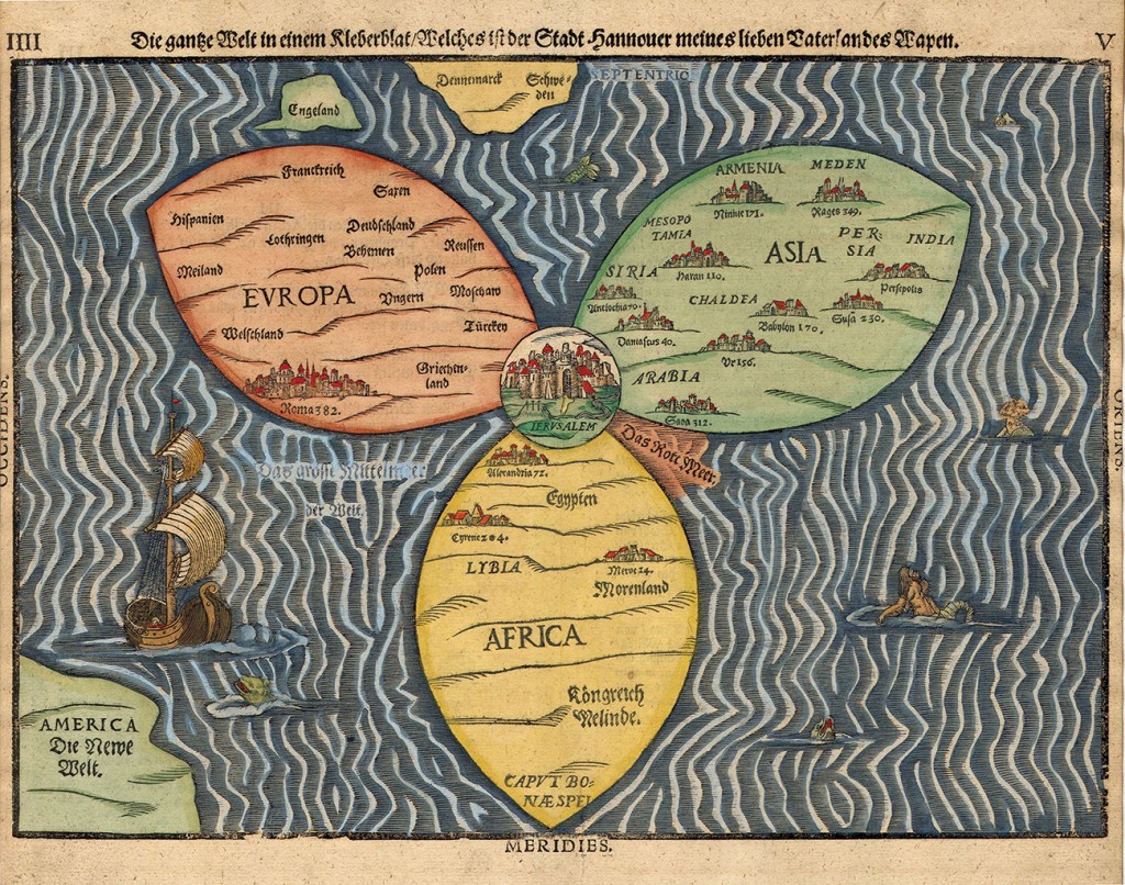
The Bünting Clover Leaf Map is a mappa mundi drawn by the German Protestant pastor, theologian, and cartographer Heinrich Bünting. He published it as a symbolic, whimsical illustration in his book Itinerarium Sacrae Scripturae (Travel through Holy Scripture) that is basically the bible rewritten as an illustrated travel guide.i It depicts the world in the shape that is both a symbolization of the Christian Trinity and a component of the crest of Bünting’s home city, Hannover. Today, the map is found in the Eran Laor collection in the National Library of Israel, Jerusalem and a mosaic model of it is installed on the fence of Safra Square, near Jerusalem’s city hall.
Jerusalem is in the center of the map (notice the three crosses on a hill and the Jordan river), surrounded by representations of Asia, Europe, and Africa that comprise a three-leaved clover shape. The green leaf at the top right represents Asia, the red leaf at the top left Europe, and the bottom one in yellow Africa; all three include captions of their various countries and illustrations of quite of their cities, among them Persepolis, Babylon, Rome, and Alexandria. The Cape of Good Hope is indicated at the south of Africa. The clover is surrounded by ocean, with illustrations of sea creatures, monsters, a mermaid, and a ship; England, and Sweden and Denmark are represented as two islands above Europe’s leaf; the Red Sea is painted in red; the Mediterranean sea is named “great in this world”, and America is partially represented at the lower left corner with the caption Die Neue Welt (The New World).
i. Available at http://maps.bpl.org/id/m8795


