The northwestern West Bank is lush with extensive, beautiful plains whose greenness stems on the one hand from natural pastures that are rich with wild, lovely colored plants, shrubs, and trees, and on the other hand from well-organized and carefully tended agricultural lands that are cultivated with fruit trees, vegetables, and field crops,i and produce the main fresh ingredients of the famously tasty Palestinian cuisine that feeds and nourishes its people. This area is called the Semi-Coastal agro-eco-zone, which has a crescent shape and includes mainly the Jenin, Tulkarem, and Qalqilya governorates. (Not to be confused with the Fertile Crescent that reaches from Lower Egypt through the Levant to Iraq and the Persian Gulf.) In terms of climate, this region is considered an extension of the Mediterranean region, with elevations ranging from 100 to 400 meters above sea level, and is characterized by relatively high average annual rainfall that varies between 624 mm for Qalqilya, 602mm for Tulkarem, and 507mm for Jenin. The semi-coastal region contains good amounts of groundwater wells that make it suitable for cultivating diversified types of crops, including field crops, vegetables, and fruit trees. There are 257 artesian wells with an annual capacity of water discharge that reaches 12.1 million cubic meters.ii

The Israeli occupation authorities covet these rich and valuable resources and have confiscated agricultural lands and water wells for settlement use; other areas have been isolated by the segregation wall. This area is called the seam zone, and here the segregation wall isolates 48,000 dunums of agricultural and fertile lands and 23 artesian wells. Restrictions have been imposed on the farmers’ access to their land and water, with the aim to render them uncultivated, a condition that automatically turns them into state land, to the benefit of the occupation. The most isolated agricultural areas are in Qalqilya Governorate and presented clearly in map (1).
The latest agricultural census, published by the Ministry of Agriculture and the Palestinian Central Bureau of Statistics (PCBS) in 2010, estimated that the total area of agricultural land in Palestine constitutes about 1,207,061 dunums. Of these, 91.6 percent or 1,105,146 dunums are located in the West Bank, and 8.4 percent or 101,915 dunums in the Gaza Strip.iii Ten years ago, the total area of arable land cultivated by Palestinian farmers reached 1.9 million dunums. However, restrictions imposed by the Israeli occupation on Palestinian farmers’ access to their water resources and agricultural lands has generated two types of losses for the Palestinian agricultural sector: First, the amount of crop that could be harvested from cultivated lands has been reduced, as Israel has limited Palestinian access to water. Thus, the area of agricultural lands that can be irrigated has been reduced to only 12 percent of the cultivated land in Palestine. Furthermore, the limited access to water resources for agriculture is exacerbated by competition with the progressively increasing demand on water for domestic and industrial uses – significantly increasing water prices as well. Second, both limited physical access of farmers to their lands and the scarcity of irrigation water to provide even supplementary irrigation to the planted trees and crops have reduced cultivable agricultural lands by 32 percent. With impeded possibility of cultivation, the productivity of these lands has become unfeasible, which has forced farmers to stop cultivating them.iv
As the Israeli government provides Palestinians with only 138.5 million cubic meters, or 20 percent of the amount of water agreed upon in the Oslo Accords, the amount of land that is inaccessible to Palestinians – even though suitable for cultivation and irrigation – is estimated at 326,400 dunums. These lands require 189 million cubic meters of irrigation water yearly (which equals 27 percent of the Palestinian water resources). If these unexploited agricultural areas were to be made accessible, irrigated, and cultivated, the resulting additional range of agricultural and forest lands would result in an additional US$704 million of added value to the Palestinian economy (an amount equivalent to 7 percent of the GDP of 2011), and the increased agriculture contribution to the Palestinian GDP would reach up to 14-20 percent.v
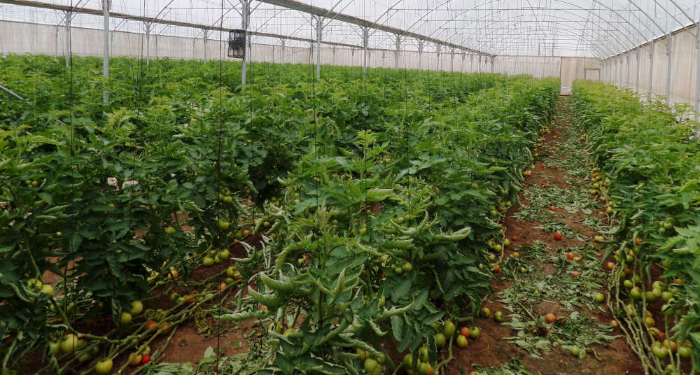
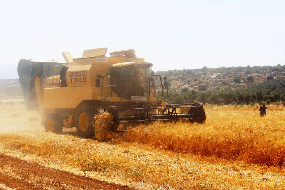
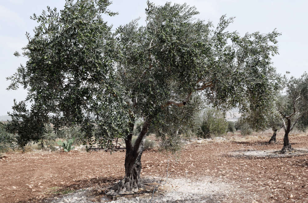
Almost 90 percent of the total irrigated agricultural lands in Palestine are concentrated in the Semi-Coastal and Jordan Valley regions.vi The semi-coastal region of the West Bank contains 336,998 dunumsvii of agricultural lands (36.2 percent of the total cultivated lands) and produces 149,369 tons of vegetables, fruits, and field crops per year, (42.3 percent of the total plant production).viii Fruit trees occupy the largest area of the cultivated lands, growing 28 types that include olives, citrus, avocado, pomegranate, annona (custard apple), guava, etc. Field crops and forages also include 28 types, with wheat, barley, dry onion, chickpeas, alfalfa, potato, and herbs such as cichorium (common chicory), anise, dill, sage, thyme, mint, chamomile, black cumin, and cumin, etc. Next come vegetables, where farmers cultivate 27 types of crops that include cucumbers, tomatoes, squash, green and yellow beans, paprika, cauliflower, cabbage, fennel, etc.ix Accordingly, this area is considered a main contributor to the Palestinian food basket in the West Bank (fig. 1). Irrigated vegetables are mainly cultivated in open fields or under tunnels (protected with plastic sheets) and inside green houses. This method gives farmers the opportunity to produce vegetables all year round, due to the prevailing moderate to warm temperatures in this region.
The closeness of this semi-coastal region to the Mediterranean Sea gives it singularity with regard to the prevailing climatic conditions that come close to the tropical climate. This has enabled farmers to introduce new crops such as the custard apple, guava, opuntia ficus (prickly pear), avocado, mango, and pineapple. These varieties will contribute to the diversification of the produced crops and increase the marketing opportunities for Palestinian farmers. For example, guava cultivation has progressively increased over the past 10 years, and the total cultivated area reached 3,000 dunums (most of this area is concentrated in the northwestern part of the West Bank), producing up to 15 tons of guava fruits yearly. A portion of the produced guava fruits is exported to the Jordan market.x
The agricultural sector is one of Palestine’s major economic sectors and the only sector that can host the labor forces that have migrated from other sectors, especially during periods of political conflict. Despite the fact that the contribution of this sector to the GDP has decreased to 3 percent, it hosts 7.5-10.5 percent of the employed persons in Palestine.xi
The farmers of this region, where agriculture dominates as one of the main economic sectors, are very creative and active as they have inherited this career path from their fathers and grandfathers. Agriculture is considered part of the socioeconomic structure of this area; thus, 10,205 farmers own agricultural holdings, whether they are plant-production, livestock-production, or a mix of plant- and livestock-production holdings. Agriculture activities are practiced here as part of a self-sufficient farming system and as agribusiness. These numbers of agriculture holdings that exist in the semi-coastal region comprise 37 percent of total agricultural holdings in the West Bankxii It is worth mentioning that 80 percent of these agricultural holdings are plant-production holdings, followed by mixed agricultural holdings, and finally livestock holdings.
The semi-coastal region is also distinguished by its livestock-production holdings, both in terms of numbers and diversification. The three governorates raise 6,627 heads of cattle for milk and meat production, which forms 27 percent of cattle numbers in the West Bank. In addition, the farmers raise 93,499 heads of sheep, including various strains that include Assaf and Baladi as well as hybrids, forming 18 percent of the sheep heads raised in the West Bank. Furthermore, the farmers raise 24,240 heads of various strains of goats, including local (Samar), Shami, and hybrids, forming 11 percent of the goat heads raised in the West Bank. Regarding the breeding of birds in this region, farmers raise 1.15 million broiler chickens and 637,000 layer chickens. During the last ten years, Palestinian farmers have begun the new practice of raising turkeys, and the farmers of this region have managed to raise a total of 348,000 turkeys, which forms 71 percent of the West Bank turkey numbers.
“The value of agricultural exports has grown by 32 percent since 2011, reaching US$56.7 million in the year 2013, which constitutes 6.3 percent of the total value of Palestinian exports.xv In addition, agriculture plays a major role in the conservation of the environment and supplies other sectors with inputs.”
“The Palestinian Farmer:
Production Analysis & Challenges,” Applied Research Institute-Jerusalem.
Contributing 37 percent to the local food production in Palestine, the farmers living in the northern governorates of Tulkarem, Jenin, and Qalqilya are main contributors to the Palestinian food basket, providing many varieties of fruits, vegetables, and herbs that provide the ingredients for the delicious and healthy Palestinian cuisine. The uniqueness of the northern part of the West Bank comes from the prevailing climatological conditions, the proximity to the Mediterranean Sea, fertile soil, wide areas of agricultural plains, good amounts of rainfall, and warm temperatures, which result in an environment suitable for growing a diversified range of crops and trees. This area contributes about US$119.1 million yearly to the Palestinian GDP in the West Bank.14 It not only contributes to the goal of achieved self-sufficiency in the production of vegetables, figs, poultry meat, eggs, and honey in the West Bank, but it also helps to reduce the demand on the import of tropical fruits mentioned above and is a main contributor to the turkey market in the West Bank. This area creates jobs for 3,461 waged workers, who form 27 percent of the waged workers in the West Bank, 19 percent of whom are female. It is worth mentioning, moreover, that 24,990 persons among northern West Bank citizens work in agriculture as unpaid labor, as they are working with their families’ agriculturexiv This shows that these communities depend heavily on agriculture. They remain rural areas, where all Palestinians can enjoy the feeling and taste of nature and wilderness.
i ARIJ, 1997, The Status of the Environment in the West Bank, available at https://www.arij.org/files/admin/1997-3_The_Status_of_the_Environment_in_the_West_Bank.pdf.
ii ARIJ, 2018, GIS and Remote Sensing Department.
iii “Agriculture Census 2010,” Palestinian Central Bureau of Statistics (2011), available at http://www.pcbs.gov.ps/Downloads/book1818.pdf.
iv Major national accounts 1994−2016, PCBS, available at http://www.pcbs.gov.ps/Portals/_Rainbow/Documents/E.NA_Current.htm.
v “Area C and the Future of the Palestinian Economy, ” World Bank Study (2014), available at https://openknowledge.worldbank.org/bitstream/handle/10986/18930/893700PUB0978100Box385270B00PUBLIC0.pdf.
vi This refers to lands for which irrigation water is available.
vii 1 dunum = 0.1 hectare
viii “Crop Production Statistics,” Palestinian Central Bureau of Statistics (PCBS), available at http://www.pcbs.gov.ps/site/lang__en/887/Default.aspx.
ix “Palestine in Figures: Agriculture 2006/7,” PCBS (2008), available at http://www.pcbs.gov.ps/Downloads/book1432.pdf.
x “Jawafa is being exported to Jordan,” (in Arabic), Palestinian News and Info Agency, September 22, 2016, available at http://www.wafa.ps/ar_page.aspx?id=jruPfHa710102913300ajruPfH.
xi “Palestine in Figures,” PCBS (2016), available at http://www.pcbs.gov.ps/Downloads/book2261.pdf.
xii “Agriculture Census 2010.”
xiii UNCTAD, “The Besieged Palestinian Agricultural Sector,” 2015, available at http://unctad.org/en/PublicationsLibrary/gdsapp2015d1_en.pdf.
xiv “Agriculture Census 2010.”
xv “Annual National Accounts,” PCBS (2012), available at http://www.pcbs.gov.ps/site/lang__en/741/default.aspx.